skip to main | skip to sidebar

Map Blog

Friday, August 8, 2008

Cartographic Animations


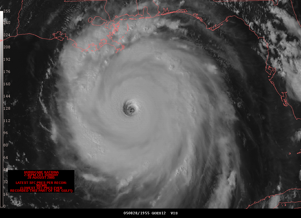
Cartographic animations are generally useful or helpful for showing events when only discrete GI is available. If the cartographic representation has not maintained the integrity of the GI, then substantial errors and distortions can occur. This is a cartographic animation of Hurrican Katrina as it nears New Orleans.
Posted by Map Blog at 10:46 AM

No comments:

Post a Comment

Newer Post Older Post Home
Subscribe to: Post Comments (Atom)

Blog Archive

  • ▼  2008 (53)
    • ▼  August (41)
      • Range graded proportional circle map
      • Continuously variable proportional circle map
      • DOQQ
      • DEM
      • DRG
      • Isopleth
      • Isobars
      • LIDAR
      • Cartographic Animations
      • Infrared aerial photo
      • Bilateral Graph
      • Statistical maps
      • Cartograms
      • Flow Maps
      • Isoline Maps
      • Proportional circle maps
      • Isotach
      • Isohyet
      • Accumulative line graph or Lorenz curve
      • Index Value Plot
      • Scatter Plots
      • Choropleth Maps
      • Dot Distribution Map
      • A population profile is a chart showing the number...
      • Climograph
      • Windrose
      • Propaganda Maps
      • Parallel coordinate graphs can show multivariate r...
      • Triangular Plot
      • Histogram
      • Box Plot
      • Stem and Leaf Plots
      • Similarity Matrix
      • Correlation Matrix
      • Star Plots
      • Hypsometric maps
      • PLSS maps
      • Cadastral maps
      • Thematic Maps
      • Topographic Map
      • Planimetric Map
    • ►  July (9)
    • ►  June (2)
    • ►  May (1)

About Me

Map Blog
View my complete profile